Gallery and Map of Public Art


Loading map...
Expand Map
-
 Abinojii Mikanah (formerly Bishop Grandin) Overpass and Chancellor Station
(Un)Still Life with Spoked Wheels
-
 Ellice Avenue, between Spence Street and Colony Street at the North entrance to the University of Winnipeg
city.block.stop
-
 BLUE Rapid Transit Line
Connecting Roots Along the Red River: Public Art on the BLUE Rapid Transit Line
-
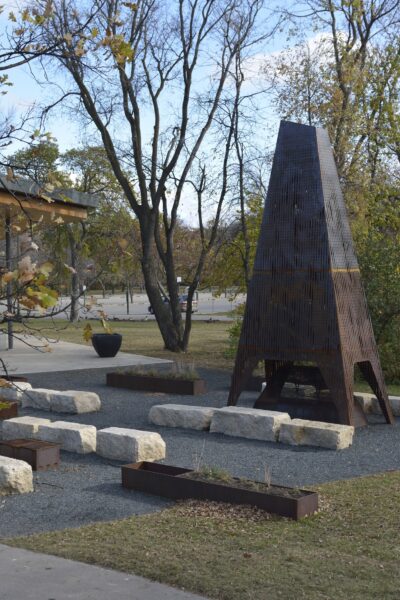
 McGillivray overpass and Seel Station
Furrows on the Land (The Field) / Furrows in the Land (The Wheel)
-
 Markham Station
Métis Land Use
-
 Beaumont Station, Georgina Avenue at Parker Street
Rooster Town Kettle and Fetching Water
-
 Clarence Station
ROW ROW ROW
-
 Chevrier Station
Salt Fat Sugar & Your Water is Safe: a project for the commons
-
 St. Anne's at St. Mary's Road
Watershed
-
 Winnipeg Transit, Winnipeg Public Library and now in Air Canada Park
Winnipeg Words
-
 Plaza Station
テンサイ (Tensai)
All artworks featured have been created since the inception of the Public Art Policy and Program in 2004, and are part of the evolving Collection of the City of Winnipeg unless otherwise noted.