The place where Clarence Station and ROW ROW ROW stand marks a meeting point between residential and industrial Winnipeg. The BLUE Line cuts a swath between the western industrial lands and the eastern suburban developments of Fort Garry. Winnipeg’s history of civic planning in this area dates back to the early 1800s, and was shaped by the relationship between nature and human habitation.
Unlike the standardized grid road system of many prairie cities, some of Winnipeg’s main roads, including Pembina Highway, are the meandering product of its history as a fur trade hub and farming settlement. Radiating out from historic river trails that now exist as major roadways and thoroughfares in the city, property plans in the area began in 1817 with Hudson’s Bay Company fur trader Peter Fidler, who laid out lots perpendicular to the rivers based on the French Canadian “Seigneurial System” (also known as the river lot or long lot system). Each narrow property was afforded access to water and river transportation, creating the main north-south trails along the river.
Running two miles west from the river, each property held a house, barn, stables and gardens, allowing ample space for gardening and livestock for each family while keeping neighbours close by along the river trail. At the two-mile mark, another trail signalled the beginning point of each property’s two-mile-long hay privilege of the open prairie beyond. The prairie contained long grasses that were used for animal feed and farming. Through the middle of the 19th century, the Red River Colony was surveyed in this fashion from the Assiniboine River all the way south to present-day St. Adolphe. While the river lots were mostly subdivided into town lots when the civic region of Fort Garry quickly grew into a Winnipeg suburb during the early- to mid-20th century, the city retains this unique framework for its natural-history-based road system.
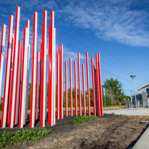
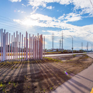
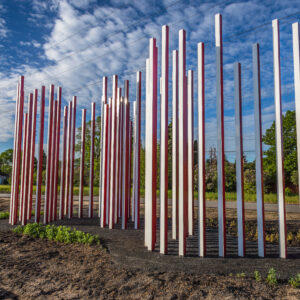
The long narrow posts of ROW ROW ROW represent the parcels of divided settled land of the seigneurial lot system. The path of the posts represents the Red River, as it bends and twists through Fort Garry. Bold colours on each side of the posts transforms the structure as one walks, bikes, or rides by on a bus.
This work is was created through the Winnipeg Arts Council’s Public Art Program in collaboration with Winnipeg Transit, PCL, and Plenary Group as part of Winnipeg's SouthWest Rapid Transitway expansion project.


